


Voting District 44332, Los Angeles County, California
About
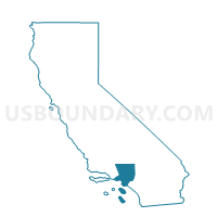
Outline

Summary
| Unique Area Identifier | 534084 |
| Name | Voting District 44332 |
| County | Los Angeles County |
| State | California |
| Area (square miles) | 0.56 |
| Land Area (square miles) | 0.56 |
| Water Area (square miles) | 0.00 |
| % of Land Area | 100.00 |
| % of Water Area | 0.00 |
| Latitude of the Internal Point | 33.92164860 |
| Longtitude of the Internal Point | -118.00382020 |
Maps


Graphs
Select a template below for downloading or customizing gragh for Voting District 44332, Los Angeles County, California


Neighbors
Neighoring Voting District (by Name) Neighboring Voting District on the Map
- Voting District 43963, Los Angeles County, CA
- Voting District 44272, Los Angeles County, CA
- Voting District 44278, Los Angeles County, CA
- Voting District 44329, Los Angeles County, CA
- Voting District 44347, Los Angeles County, CA
Top 10 Neighboring County Subdivision (by Population) Neighboring County Subdivision on the Map
Top 10 Neighboring Place (by Population) Neighboring Place on the Map
Top 10 Neighboring Elementary School District (by Population) Neighboring Elementary School District on the Map
- East Whittier City Elementary School District, CA (73,117)
- Lowell Joint Elementary School District, CA (34,371)
Top 10 Neighboring Secondary School District (by Population) Neighboring Secondary School District on the Map
- Fullerton Joint Union High School District, CA (249,728)
- Whittier Union High School District, CA (218,195)
Top 10 Neighboring Unified School District (by Population) Neighboring Unified School District on the Map
Top 10 Neighboring State Legislative District Lower Chamber (by Population) Neighboring State Legislative District Lower Chamber on the Map
- Assembly District 60, CA (439,072)
- Assembly District 58, CA (429,216)
- Assembly District 56, CA (425,338)
Top 10 Neighboring State Legislative District Upper Chamber (by Population) Neighboring State Legislative District Upper Chamber on the Map
Top 10 Neighboring 111th Congressional District (by Population) Neighboring 111th Congressional District on the Map
Top 10 Neighboring Census Tract (by Population) Neighboring Census Tract on the Map
- Census Tract 5037.03, Los Angeles County, CA (7,876)
- Census Tract 5035.01, Los Angeles County, CA (6,481)
- Census Tract 5040.01, Los Angeles County, CA (5,709)
- Census Tract 5037.02, Los Angeles County, CA (5,040)
- Census Tract 5037.01, Los Angeles County, CA (4,717)
- Census Tract 5036.01, Los Angeles County, CA (4,168)
- Census Tract 5035.02, Los Angeles County, CA (4,130)
- Census Tract 5036.02, Los Angeles County, CA (3,793)